

What Does Not Return
A data center on South Pine Street promises not to draw from the aquifer. West of the fall line, there is no aquifer to draw.

Near the black walnut in our backyard that I often write about here, there’s a place where I have learned to watch rain go somewhere. In the Piedmont, rain doesn’t so much soak as leave. The soil in Spartanburg is thin over rock that was once the deep roots of mountains, and a hard shower runs almost at once into the low places, gathering toward Lawson’s Fork, Fairforest Creek, many tributaries and smaller creeks, over the shoals, down to the Pacolet and the Broad, and at long last the Atlantic. Standing there beside the black walnut in our sloped yard that pitches down to a creek that turns into the dammed-up Duncan Park Lake through a storm is to learn that the water here is weather, held for a little while on its way downhill. It isn’t banked beneath me at any depth. It passes through, and what the ground keeps, it keeps briefly, in the first few feet, in the leaf litter and the saprolite, before letting it go. And the way it passes, I have come to understand, is not original to the place. It was actually taught.
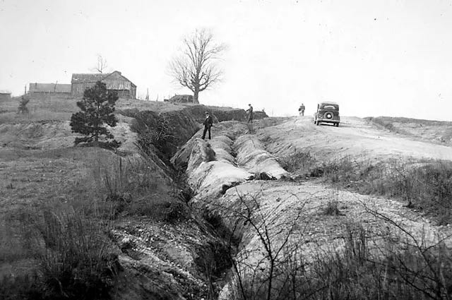
The Piedmont learned to shed water this way over two hard centuries. When William Bartram traveled through in the 1770s, he described streams running clear. The rivers we have now often run red after a storm, turbid with upland clay soil, and the difference is… cotton. Deforestation and cultivation through the eighteenth and nineteenth centuries stripped the thin topsoil and cut gullies into the red Cecil clay, scars that still lie under the second-growth pine across the Upstate and down through the Sumter National Forest towards the Midlands and Fall Line of our Carolina river systems.
Forest Service researchers who have worked over the past few decades to wire gullies with weirs and moisture sensors found a ground that holds little water. Of eight gullies, only four ran at all across a season, and small rains of six millimeters, then thirteen, passed without producing any flow because the soil was too dry to carry them, until back-to-back days of harder rain finally pushed it past saturation. The land wets at the surface and sheds in pulses, and when it runs, it carries the soil with it. The speed of the water here is the signature of an old taking, and a gully is the place where that taking is still legible in the ground.
I have been thinking about that passage of water and the flows in the Upstate because of a sentence that the NorthMark data center on South Pine Street here in Spartanburg keeps offering as a source of comfort. NorthMark, building its computing facility in the shell of the old Kohler plant, says its water will be drawn “entirely from municipal supply with no draw from groundwater or aquifers,” and that its projected use stays “within approved limits.” Spartanburg Water estimates the facility will take around 460,000 gallons a day, close to 2,000 households’ worth, or somewhere between 1.8 and 2.3 percent of the system’s daily demand.

The company says the cooling water will be treated on site and discharged back to the municipal system, and that it will be tested by third parties against the permit. The utility’s chief executive has said the facility would be about half the size of its largest industrial customer. NorthMark has called high-performance computing significantly less water-intensive than the manufacturing or the other “cloud” data centers it is measured against. And the reporting notes, almost as an aside, that most of the water will be lost to evaporation, which I’ve written about here:
What Evaporates

There’s a drought here in South Carolina. We had rain this morning, which is helpful, but it’s going to take exceptional spring rainfall in these remaining few weeks before summer to get us back to baseline. You can see it in Lawson’s F…
All of those statements are true. I want to take them seriously, and that means noticing what kind of sentence each one is. They are comparisons. A percentage of the system’s demand. A multiple of a household. A fraction of the old Kohler permit. A ratio against other, thirstier industries. The comparison does the persuasive work before any argument is made, by deciding in advance what water is. Inside the frame of the comparison, water becomes a quantity and a stock of interchangeable gallons drawn down and replenished and accounted in aggregate, in the way a budget accounts for dollars. This is the same frame the trade press has been settling into for a few years now. A recent Wired piece on the industry trying to address its water use is built almost entirely of these comparisons: a Lawrence Berkeley report projecting that hyperscale centers could consume up to 33 billion gallons a year by 2030, set immediately beside the reminder that this is on par with or less than agriculture or oil and gas, that a single fracked well can swallow one and a half to sixteen million gallons. And let’s not forget about those pesky golf courses that often get brought into conversations about water here in the Upstate! The numbers are arranged to be absorbed.
A line from Shaolei Ren, the engineer at Riverside who has done much of the careful accounting, stands out to me in this framing. Water, he says, is “a highly local, highly regional issue.” It’s the truest sentence, and the discourse around it spends most of its energy doing the opposite of what the sentence asks of us to perceive. To say water is local is to say it cannot be moved into a column and balanced against water somewhere else. The gallon evaporated over South Pine Street isn’t the same gallon that stays in the ground beneath a county in Texas, or returns to a river in Iowa, even though the ledger treats them as fungible. The comparison is a way of looking that resolves a felt unease by relocating it into an accounting that comes out even, much like we do with GDP or life expectancy numbers and comparisons. The cost of that way of looking is the creek. You stop seeing the particular water in the particular place, because the frame has taught your attention to go to the percentage instead.
Here is where the aside about evaporation matters more than it should. The language of treatment and discharge, water returned to the municipal system, and tested against the permit, describes a loop, or water “given” back.
But evaporation is precisely the part that does not loop back to here. It’s a phase change. Surface water becomes vapor and is carried off, and whatever rain it eventually becomes will fall on some other watershed by some other logic of wind. In the Piedmont, this matters in a specific way because the water was surface water to begin with. It was the same weather I watch leave the yard, caught in the reservoirs on the Pacolet, Lake Bowen, and the impoundments that hold our share of the rain before it sheds downhill. The evaporated fraction of those 460,000 gallons is weather intercepted on its way through and sent up rather than down, out of the Lawson’s Fork drainage, out of the catchment the walnut and the shoals belong to. The longer I’ve worked on this issue of perception with data centers and water usage, the more I think evaporation is the honest center of the whole question, and the place where the budget cannot follow the water, because a budget can count gallons in a system and cannot perceive a watershed.
But the sentence I keep returning to in my head from my previous writing on evaporation is the one about the aquifer, because it reveals how far the comforting vocabulary has traveled from the ground it is spoken over. “No draw from groundwater or aquifers.” The coastal plain rides on a thick wedge of sand, clay, and limestone that the U.S. Geological Survey has sorted into a stack of named aquifers, the surficial layer near the top and then, going down: the Floridan, the Tertiary sand, the Black Creek, the Middendorf, and the Cape Fear, each separated from one another by confining beds of clay. Those aquifers recharge slowly, mostly from rain falling on their outcrops near the fall line, and the water then creeps downgradient through the confined layers for a very long time before anyone’s well reaches it. It is, in a real sense, a bank, and it can be overdrawn. The Survey’s modeling shows head declines across much of the eastern coastal plain in the Black Creek and Middendorf aquifers, drawn down for decades by the pumping around Florence and Myrtle Beach, water taken from storage faster than the slow recharge can replace it.
Spartanburg is on the other side of the fall line. The line runs across the middle of the state, through Columbia, as seen in the rocky convergence of the Saluda and Broad Rivers into the Congaree River, and west of it, the layered wedge gives out entirely. The Piedmont sits on crystalline rock, ancient granite and gneiss, and what groundwater exists hides in fractures and in the weathered zone above the bedrock, in yields too small and too local to supply a city. There is no Middendorf here, no deep bank of slow water to spare. Our water is the rain, caught at the surface, in the reservoirs on the Pacolet headwaters, the same system that feeds the shoals where I sit.
So when the NorthMark facility on South Pine Street promises no draw from groundwater or aquifers, it is describing a restraint the geology has already imposed, in terms borrowed from a hydrology that begins a hundred miles to the east. It is the right sentiment for the Pee Dee, offered to the Piedmont, where it sounds like forbearance and means almost nothing, because the water it promises to spare was never there to take. The 460,000 gallons will come, as it must, from the surface, from the weather, from the same held rain the walnut drinks.
I am not yet trying to reach a verdict. The verdict belongs to the rooms where it is properly argued, to the Department of Environmental Services, the turbine permits, and the hearing that the neighbors and the lawyers have asked for, the one with no date set.
What I am after is something prior, the thing my whole practice at this spot beside the walnut keeps insisting comes first. Before we can ask whether 460,000 gallons a day is too much, we have to be able to see the water as this water, Piedmont surface water, weather briefly held, the creek’s water, the reservoir’s water, and the cooling tower’s water, all drawn from one shedding system. The comparison is not a lie. It is a way of looking, and like every way of looking, it shows some things by hiding others, and what it hides is the place. The discipline is to keep the place in view, to let the percentage stay a percentage without becoming the whole of what we can perceive.
There is a long memory in this. Two centuries ago, the taking here was of soil, and the water carried it out of the uplands and into the rivers, where it still clouds them. The taking now is of the water itself, lifted off the surface and into the air over South Pine Street. The ledger reads neither, because it counts gallons in a system at a single moment and cannot hold a watershed across time. The rain is leaving the yard again as I write this. It is going where it has gone since the gullies opened, toward the fork and the shoals and the river, carrying its red memory of the last extraction, except for the share of it, across town, that will go up instead, and not come back down here.
Sources
Hydrology and land-use history
Galang, M.A., C.R. Jackson, L.A. Morris, D. Markewitz, and E.A. Carter. 2007. “Hydrologic Behavior of Gullies in the South Carolina Piedmont.” Proceedings of the 2007 Georgia Water Resources Conference, March 27–29, 2007, University of Georgia, Athens. (USDA Forest Service Treesearch no. 28844.)
Aucott, Walter R. 1996. Hydrology of the Southeastern Coastal Plain Aquifer System in South Carolina and Parts of Georgia and North Carolina. U.S. Geological Survey Professional Paper 1410-E. https://doi.org/10.3133/pp1410E
Trimble, Stanley W. 1974. Man-Induced Soil Erosion on the Southern Piedmont, 1700–1970. Ankeny, Iowa: Soil Conservation Society of America.
Bartram, William. 1791. Travels Through North and South Carolina, Georgia, East and West Florida. Philadelphia: James & Johnson. Naturalist edition, Francis Harper, ed. (Athens: University of Georgia Press, 1998).
The data center and its water
Taft, Molly. “Data Center Operators Are Trying to Fix Their Water Use Problems.” Wired. https://www.wired.com/story/data-center-operators-fix-water-use-problems/ (Source of the Shaolei Ren quotation and of the Lawrence Berkeley National Laboratory projection of up to 33 billion gallons of annual hyperscale water use by 2030.)
Boschult, Christian. “Spartanburg data center plans to use 460K gallons of water per day. Here’s what that means.” Post and Courier, May 2026. https://www.postandcourier.com/spartanburg/news/spartanburg-northmark-data-center-water-use/article_a561843e-a832-45c7-ab24-2af7906fcefa.html (Source of the daily-use figures, the share of system demand, and the note that most of the water is lost to evaporation.)
“Company provides update on data center under construction in Spartanburg.” WSPA 7News, May 2026. https://www.wspa.com/news/local-news/company-provides-update-on-data-center-under-construction-in-spartanburg/ (Source of the “within approved limits” and “no draw from groundwater or aquifers” statements and the continuation of the former Kohler water permit.)
“NorthMark data center under scrutiny from neighbors, advocacy groups.” Post and Courier, May 2026 (syndicated). https://www.aol.com/news/northmark-data-center-under-scrutiny-152438775.html (Source of the Spartanburg Water chief executive’s comparison to the system’s largest industrial customer and of the public-hearing requests from Sen. Shane Martin and the Southern Environmental Law Center.)
“How data centers could soon impact Upstate South Carolina.” Post and Courier, August 28, 2025. https://www.postandcourier.com/spartanburg/business/data-centers-impact-upstate-south-carolina/article_51663172-012d-46a8-ba74-f134d368cab1.html (Source of the company’s claim that high-performance computing is less water-intensive than manufacturing or cloud data centers, and of the South Pine Street site details.)
Spartanburg Water. System and source-water information (Lake Bowen and the Pacolet River reservoirs). spartanburgwater.org